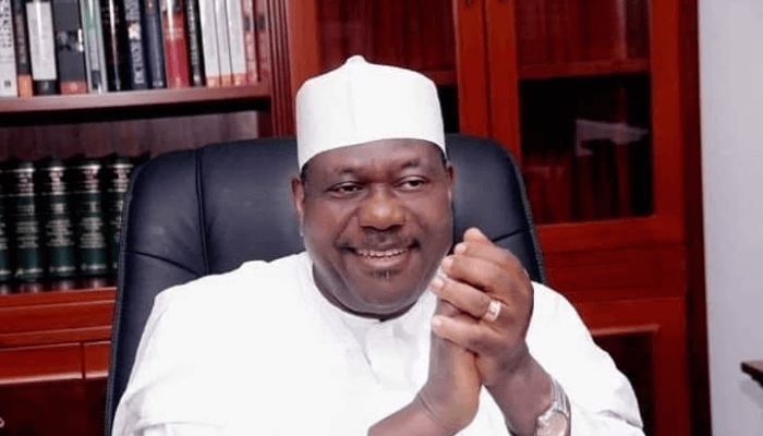
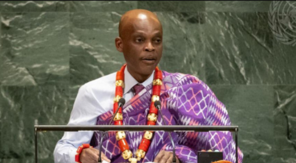
Last week, Togo placed Africa’s representation at the center of global debate during the 80th United Nations General Assembly. Taking the floor, Foreign Minister Robert Dussey directly confronted the long-standing cartographic distortions inherited from the 16th-century Mercator projection. He argued that this outdated mapping system shrinks Africa’s true size while inflating Europe and North America.
To make his point clearer, Dussey highlighted Africa’s undeniable scale. With 30.3 million square kilometers of land and a population projected to reach nearly 1.5 billion by 2030, Africa represents about 20% of the world’s land area and 18% of its people. Yet, on the most commonly used maps, the continent appears smaller than Greenland, a territory less than one-fifth its actual size.
As he explained, this distortion goes beyond geography. It shapes perceptions, influences geopolitics, and contributes to a narrative that underestimates Africa’s weight in world affairs. By consistently minimizing Africa on maps, global consciousness absorbs a false impression of the continent’s significance. Dussey did not mince words, declaring, “Africa is intentionally minimized,” and reminding delegates that Africa could physically contain the United States, Russia, India, France, the United Kingdom, and China combined.
This bold intervention underscored Togo’s commitment to ensuring that Africa’s voice is heard on the world stage. By drawing attention to something as seemingly technical as mapmaking, Togo reminded leaders that representation matters deeply. When maps distort reality, they reinforce old hierarchies of power. Correcting these distortions is not only a cartographic issue but also a step toward global justice.
Dussey’s remarks resonated because they connected history with present realities. The Mercator projection, designed for navigation during Europe’s colonial expansion, conveniently magnified northern countries while shrinking equatorial regions like Africa. That projection, however, still dominates classrooms, offices, and media today, subtly reinforcing outdated power dynamics. By confronting this legacy, Togo invited the world to reconsider how knowledge and perception are shaped by the tools we often take for granted.
Furthermore, Dussey’s speech served as a call for Africa’s growing influence to be recognized in international governance. With its massive population, rich resources, and strategic importance, Africa can no longer be sidelined in global decision-making. By challenging the way the world literally views the continent, Togo emphasized the urgency of giving Africa the voice it deserves in shaping international policies.
The intervention sparked important reflections across the Assembly. Delegates acknowledged that representation is not symbolic alone; it carries practical consequences. A continent repeatedly minimized in maps risks being underestimated in trade negotiations, global policy, and cultural respect. By contrast, an accurate portrayal strengthens the case for Africa’s inclusion and rightful influence.
As the session closed, Togo’s message stood out for its originality and its courage. In a setting often dominated by speeches on conflict, climate change, and finance, raising the politics of maps may have seemed unusual. Yet, it proved powerful because it linked geography, history, and justice in one clear argument. Togo reminded the world that Africa deserves not only fair treatment in economic and political structures but also in the very images that shape global consciousness.
In essence, Togo’s stand at the UN was more than a cartographic critique. It was a demand for recognition, dignity, and fairness for a continent that continues to rise.